 |
 |
 |
 |
As noted in last month’s Weston News, you can now once again walk the Bailey Lane from Hope Mansell to Bailey Brook. In talking to a number of people, I’ve been discovering a bit more about the lane.
It has appeared on every OS map since the first series, so we know it has been in use for at least 200 years. It’s probably much older – quite likely a thousand years or more. Parts of it form a definite hollow way, where through use over time, the surface has been worn until it lies below the level of the adjoining fields (one of several hollow ways in Hope Mansell).
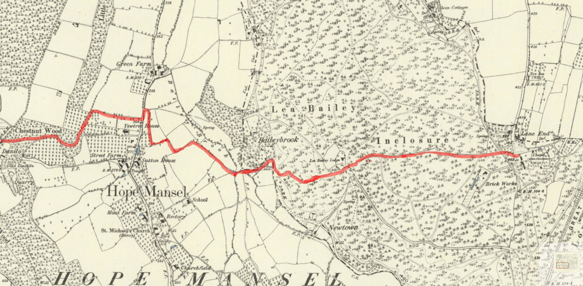
It forms the central section of a route which runs from the Lime Kilns at the top of Kiln Lane/Chestnut Lane, along the lane, and ahead through the Lea Bailey Inclosure (as the Forestry still call it) of the forest to Bailey Lane End.
Herefordshire Archaeology talks of many medieval charcoal-burning sites in the Lea Bailey Inclosure, and the possibility of iron mining. We known that iron was mined near Drybrook, so the linking of iron, charcoal, and lime (used to extract the iron from the ore) seems logical, and might even go as far back as Roman times and the days of Ariconium, which is, after all, only a couple of miles to the north.
On the 1887 map you can see that there was a Keeper’s Lodge in the centre of the Inclosure. John Margrett and others remember that before the war there was a shop there owned by Jenny Robbins, where she sold enormous gob-stoppers. John Harding tells of riding his motorbike along the lane and continuing ahead through the forest in the 1960s and 1970s. It was never wider, but was flat and smooth enough for small vehicles, and was used for milk and bread deliveries until at least the 1980s – saving a three mile road trip between Hope Mansell and Bailey Brook – and local farms used it for moving livestock until it was blocked and became overgrown around the turn of this century.
At the moment, apart from some lush nettle patches to either side of the trodden path, it has several dense areas of wild garlic, and I saw a single cuckoo pint the other day. All in all, it’s an interesting few hundred metres. (Many thanks to Ray Margrett for supplying, and to Brian Lewis for fixing the new gate at the Bailey Brook end of the lane.)

(1887 map source Ordnance Survey/National Library of Scotland.)
Ian Lewis